
Introduction
Global Positioning System (GPS) is a satellite system that is operated for navigation by using satellites, algorithms, and a receiver to coordinate location, velocity, and time data for air, sea, and voyage OR Global Positioning System (GPS) notify or provide us a location that where are we right now. It is ono of the Global Navigation Satellite System (GNSS) which helps to know geolocation, Time, and Velocity information to a Global Positioning System (GPS) receiver from anywhere, anytime on earth.
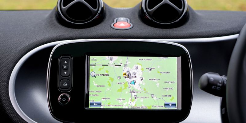
Nowadays people have Global Positioning System (GPS) in their cars, cellphones, and also in watches. It’s used for both military and civilian purposes.
Discussion
The Global Positioning System (GPS) notify or answer the following questions :
- Where is the GPS location right now?
- Where is the GPS device operator?
- Where the GPS location is travelling or going?
- What is the best route to reach there?
- When will I reach there?
History of GPS
At first, the Global Positioning System(GPS) is invented by the U.S military for use in military purposes. The concept of GPS is started in the late ’60s but still, there was no satellite system, the first satellite system originated in the month of February 1978. The Magellan military corps of the U.S military inaugurated the first-hand hand-held Global Positioning System(GPS) receiver in 1989. The Global Positioning System(GPS) was used in operation “desert storm” in 1992.
The U.S military did not prefer the use of the Global Positioning System(GPS) for civilians use, worrying that smugglers, hostile force, and terrorists use it. At last, twisting the apprehension from the corporations that built the equipment, the U.S military opened and allowed civilians to use GPS for civilian purposes as well with some restrictions and limitations. In May 2010, the U.S president Clinton pulled up restrictions and limitations and declared that the possibility to reduce civil GPS signals in tragedies would be phased out by 2010. The federal government is devoted to delivering the Global Positioning System(GPS) technology for friendly uses on a Worldwide basis, free of charge.
Components Of Global Positioning System(GPS)
Global Positioning System is mainly made up of three components or factors which is called “segments”, that coordinate together to deliver location information or services. Following are the segments:
1)User equipment Global Positioning System receivers and transmitters containing items like smartphones, watches, cars, and any other telematics equipment.
2) Satellites (Space) the space satellites which is surrounding the earth, communicating signals to the users on geographical position and time of day.
3)The Control System The GPS control system which is also called a ground segment OR functional control system. The control segment is made from Earth-based monitor stations, ground antenna, and main control stations. Ground control actions include search and operating the satellites and controlling their communications as well. There are controlling stations on every continent in the whole world.
Uses Of Global Positioning System(GPS)
Global Positioning System is the most useful, powerful, beneficial, and dependable tool which is used by many people who are related to a different occupation. GPS is used for commerce and associations in many various enterprises. Surveyors, scientists, ship captains, aeroplane pilots, mining labourers, first responders, and agricultural people use the Global Positioning System(GPS) on their daily basis. Jobs or works. They use GPS information for assembling accurate surveys and maps, taking exact time contents, tracing the location and positions, and for navigation. Global Positioning System is used any time in any weather no matter its work.
There are the owing main uses of Global Positioning System(GPS):
- Tracking GPS is used for monitoring an object’s person.
- Mapping GPS is widely used for mapping like to create maps.
- Navigation GPS is used for navigation to move one place to another place easily and fastly.
- Location GPS is mostly used for knowing the location of any object as well.
- Timing GPS is used for creating it probable to take precise time measurements.
There are some more particular uses of the Global Positioning System:
- Entertainment GPS is incorporated into games and any sports activities.
- Health and fitness GPS is used for doing health and fitness activities. Watches smartphones and any other wearable technology can help in fitness activities like in running length and duration measuring, and benchmark it against an identical demographic.
- Emergency Response Global Positioning System is used during any natural and casual calamities, first responders use GPS for mapping, following, and indicating climate, and maintaining path of emergency crew.
- Construction mining and off-road trucking Global Positioning System facilitates corporations to boost return on their assets by locating equipment, to measuring and improving assets allotment.
- Transportation Logistics or transport corporations use the telematics system to enhance a driver’s driving and safety. Like a truck tracker used in paths recognition, fuel efficiency, subordination, and driver’s safety.
- To find or locate anyone’s location GPS plays a vital role to find out anyone’s location. It’s often used by the police department or criminal investigation departments to find out criminals. It is very easy to track or locate anyone’s location by GPS if the criminal or any other person is using any trackable device.
Work Of the Global Positioning System Technology
Global Positioning System(GPS) technology works with a strategy called “trilateration”. For calculating locations, velocity, and time trilateration strategy encourages to collect indications from the satellite towards output location information. Some people often take trilateration as triangulation which is for measuring the positions, not location or distances.
The satellites which are surrounding the earth send indications towards the Global Positioning System to read and interrupt, the GPS equipment arranged on or near to the earth’s surface triangulation must be proficient to read the indication from a minimum of four satellites to measure accurate location.
Each satellite of the global positioning system in the network orbits the earth two times in a day, and all the satellites dispatch the remarkable signals, orbital parameters, and time towards the GPS. The global positioning system device can read the signals from six or more than six satellites at any given time or moment.
Conclusion
The global positioning system is a very useful and helpful satellite system which helps people in different ways and different occupations. The GPS helps most to the military, civil, and business users all over the world. The global positioning system will be more accurate and advanced in the future.
References
- Zenk, S.N., Matthews, S.A., Kraft, A.N., and Jones, K.K., 2018. How many days of global positioning system (GPS) monitoring do you need to measure activity space environments in health research?. Health & place, 51, pp.52-60.
- Renfro, B.A., Stein, M., Boeker, N., and Terry, A., 2018. An analysis of the global positioning system ( GPS) standard positioning service (SPS) performance for 2017. See https://www. GPS. gov/systems/GPS/performance/2014-GPS-SPS-performance-analysis. pdf.
- Panda, N., Solsky, I., Hawrusik, B., Liu, G., Reeder, H., Lipsitz, S., Desai, E.V., Lowery, K.W., Miller, K., Gadd, M.A. and Lubitz, C.C., 2020. Smartphone global positioning system (GPS) data enhances recovery assessment after breast cancer surgery. Annals of Surgical Oncology, pp.1-10.
- Hegarty, C.J., 2017. The global positioning system (gps). In Springer Handbook of Global Navigation Satellite Systems(pp. 197-218). Springer, Cham.